
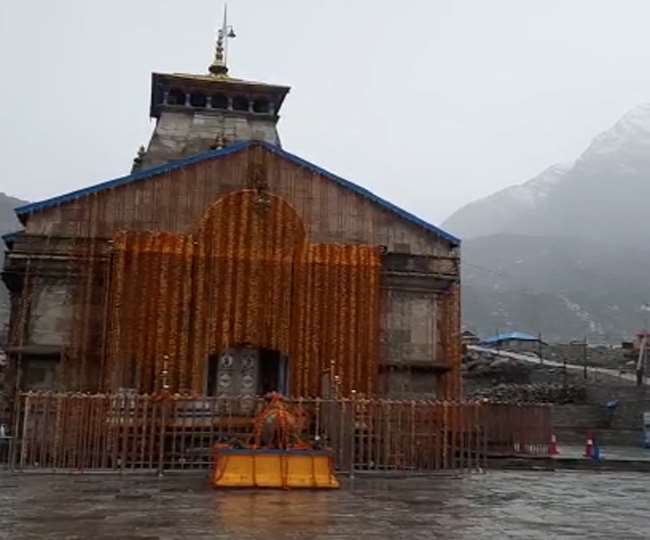
Dehradun. The effect of the Western Disturbance and Tacte Cyclonic Storm is also visible in Uttarakhand. Thick clouds have encamped here and the process of torrential rains has started. Most parts of the state, including Chardham, received rains throughout the day. Snow is also reported on the peaks of Badrinath and Kedarnath. A meteorological department has issued a red alert for heavy to very heavy rains even today. At the same time, if we talk today, it has been raining in all the districts of Uttarakhand since last day. It is snowing in the peaks of Badrinath and Hemkund Sahib. It is raining all over Rudraprayag district including Kedarnath. At the same time, the incessant rainy weather in Dehradun and Mussoorie has cooled down. Dehradun has recorded 48 mm of rain in 24 hours, which is the highest rainfall in a single day in May in the last ten years. Record rainfall has been recorded in other districts. There is a possibility of rain for the next 24 hours.
In Uttarakhand, the clouds had encamped in the sky since Tuesday night. Showers of rain started in many areas in the early hours. Light to moderate rains continued throughout the day in most areas. While many areas also received heavy rains. The snowfall occurred on the peaks of Badrinath in Chamoli and Kedarnath in Rudraprayag. The fire in the forests of Sneh in Kotdwar has also been extinguished due to the rain. Rainfall also continued in Benital, Tharali, Dewal, Garasain along with Karnprayag including Simli, Gauchar, Langasu, Noti, Nandasain, Chhappadwali, Nainisain. In Kumaon, the process of drizzle continues since Tuesday night.
The administration was on alert mode in Pithoragarh and Bageshwar districts in view of the red alert of the weather. High-altitude areas, including Munsiyari, received heavy rainfall. The Tawaghat-Lipulekh route has been closed due to debris near Garbadhar. At the same time, in Almora, Bageshwar and Champawat, the order of rain remains constant. According to the Meteorological Center, heavy to very heavy rainfall may occur at some places in Dehradun, Uttarkashi, Chamoli and Pithoragarh on Thursday. Whereas, heavy to very heavy rains are expected in Tehri, Rudraprayag, Pauri, Bageshwar, Nainital and Haridwar. Thunderstorms can be accompanied by lightning and strong showers in some areas of the state. At the same time, in the plains, winds of 50 km per hour may also blow.
10 to 12 ° C dropped mercury
The day-long rains have resulted in a drastic drop in temperature in most areas of the state. Many cities recorded maximum temperatures of 10 to 12 degrees Celsius below normal. The fall in mercury, especially in the hilly areas, has brought the cold back and people are forced to wear warm clothes.
Temperature of different cities
City maximum minimum
- Dehradun 25.3 22.6
- Uttarkashi 20.4 13.8
- Mussoorie 16.7 15.2
- Tehri 16.2 13.8
- Haridwar 28.3 21.6
- Joshimath 16.6 11.3
- Pithoragarh 17.0 14.4
- Almora 19.2 16.0
- Mukteshwar 12.5 09.5
- Nainital 14.8 10.2
- USNagar 26.5 22.5
- Champawat 16.3 12.1


Leave a Reply